Backpacking the Wonderland Trail in Four Days
A 93-mile, 27,000-foot loop circling Mount Rainier completed in four big days, with stunning views of Rainier and five other volcanoes.
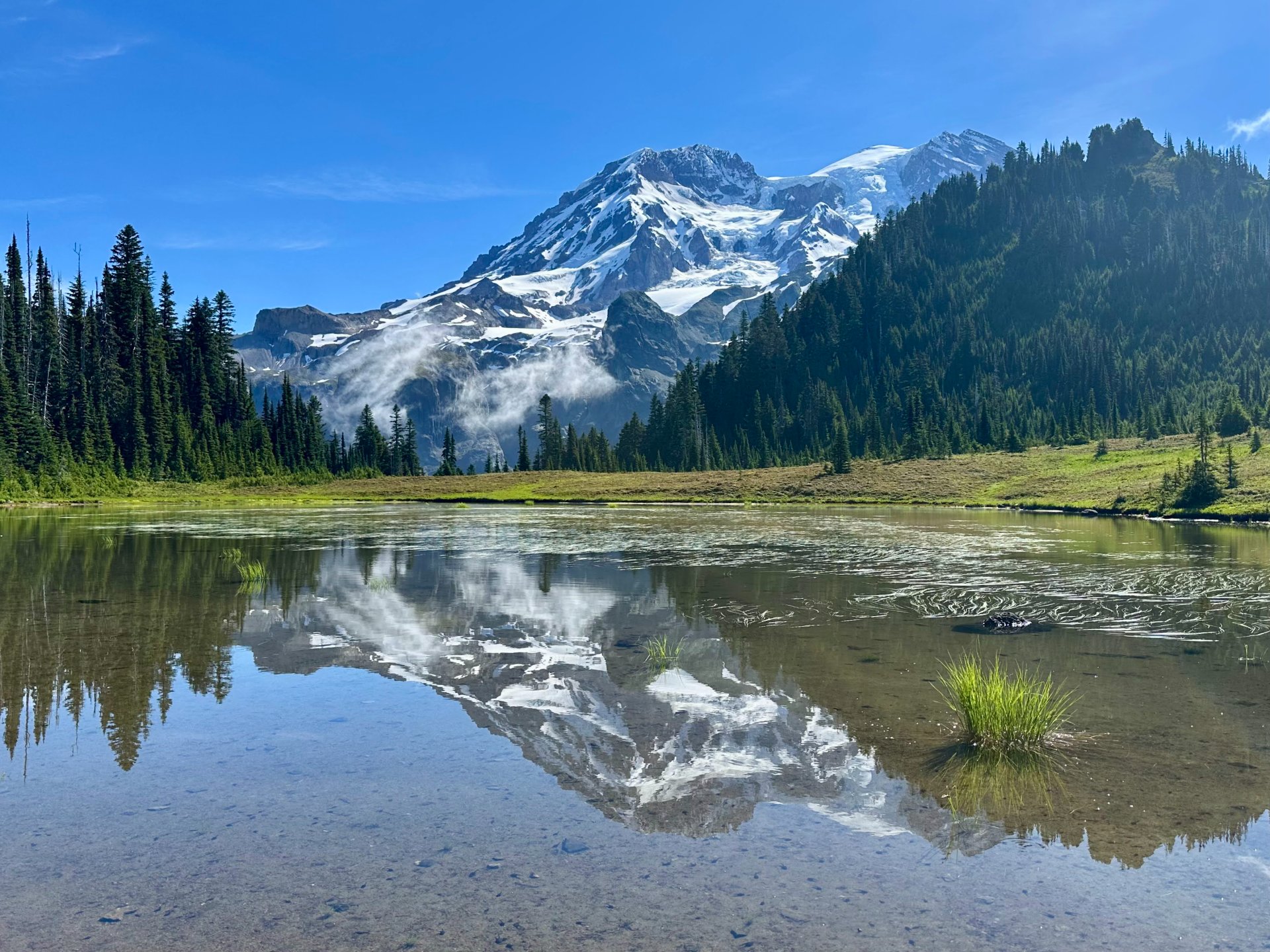
The Wonderland Trail is a gorgeous 93 mile 27,000 feet gain hike circling Mount Rainier. You get amazing views of Rainier, and we even saw five other volcanoes (Adams, Helens, Hood, Baker and Glacier). There are many miles of forested hiking with a few river crossings that can be challenging when the bridges are out. Snow can also linger well into the summer.
We didn't get lucky with the early Rainier permit lottery but when reservations opened to everyone we scored a permit for Carbon River and Golden Lakes. The day before our trip started we showed up at the wilderness information center and got a permit for Summerland! I felt four days would be the sweet spot between challenging but also having time to enjoy the views. I also wanted to make it a 100 mile trip so we added on Freemont and Tolmie.
Day 1: Longmire to Summerland — 26.9 miles, 8,533 feet
We started from Longmire (parked right by the trail at 46.75383, -121.81276) at 5:10 am and started hiking the trail counterclockwise. It seems like it is more popular to hike clockwise, but either way is just as good! Going counterclockwise the descents are usually a bit more gradual while the ascents are steeper so this can be nicer on the knees. Some people feel going counterclockwise puts Rainier behind them more often but I didn't feel this was the case. I'd go whichever way you can with the permits available.
This first part of the trail is on a very nice trail but it is a tad boring and close to the road. Stopping off at Narada Falls is a quick detour and very pretty. We saw a very cute baby deer with her mom here! Then we quickly got to Reflection Lakes which was looking very nice, thankfully it was still early enough that it wasn't very busy.
A little bit of downhill heading towards Louise Lake felt nice, there is a little bit of brushy trail here but overall still great condition. Unicorn Creek was easy to rock hop across. There is a landslide near 46.76795, -121.68992, and a short detour down to the river and back up to get around it.
Then you hike close to Stevens Creek for a few miles, the bridge was out at Maple Creek but you could rock hop or scoot across the sideways bridge. Another mile of flat forest hiking before starting to go uphill towards Box Canyon. A fun canyon to look down into, then you keep hiking up to Nickel Creek. The bridge was also out here but there was a nice log to walk on.
We filled up water here as there is a bit of a dry stretch until Indian Bar. Lots of elevation to gain before finally getting some views! Adams and Hood were out and it made all the switchbacks worth it. There was almost no snow left getting to Indian Bar.
Continuing on we gained back all the elevation we had just lost going down to Indian Bar. At 46.84316, -121.65429 we ran into snow and had patches of it for about the next 1.25 miles. The steepest part was at the end (46.85595, -121.64492). We didn't use any traction and going counterclockwise the steepest snow patches are on the downhill so we were able to easily run down them and glissade when it was steep enough. A number of people were using traction, personal preference!
Summerland camp was lovely and the marmots were out and running around, we got there at 4:45pm. There were nice rocks to have dinner on and the stream was close to camp.
Day 2: Summerland to Carbon River (plus Fremont) — 28.5 miles, 5,558 feet
The next day we had a long ways to go and got up early! At 5:30am we were hitting the trail, all the extra light in the summer is amazing. A nice few miles of downhill and then a hike along the White River till the bridge, all pretty good trail and runnable. White River campground had garbage cans but only porta potties, no water. There was a creek near the walk-in campsites.
Then the fun begins! 2.3 miles uphill and 1,942 feet of gain. It was a long forested climb till you pop out near Sunrise. A nice walk over to Shadow Lake and Sunrise camp and then a little more elevation gain to get to the ridge. There was a sign at Shadow Lake that said no drinking water. We got some water after going downhill at 46.91601, -121.69144. Fremont was a bit of a zoo but it was nice to get to hike over there and see the lookout. Keep an eye out for Baker and Glacier.
At Granite Creek camp we took a nice break and had a smoothie, I've really been enjoying those as a midday pick me up! Recipe here. A bit more downhill and we got to Winthrop Creek where there was a nice new bridge.
Some gradually gentle uphill and then we were crossing the West Fork White River. Very short and easy crossing, no bridge but a nice log to step on. After .6 mile and 370 feet of gain we made it to Mystic Camp. The camp is surprisingly far from the lake, camp sits 160 feet below and 900 feet of walking to get to the lake. Mystic Lake is very pretty though with nice mountains around it (no view of Rainier though).
At this point I was pretty ready to be done walking but we still had a ways to go! Up the pass we went and then back down the other side towards the Carbon Glacier. Dick Creek Camp actually seemed pretty nice, it's not as deep in the forest and you get a view out down the valley. We pushed on and got to the suspension bridge over Carbon River, this is the turn off for Spray Park and Carbon River Camp.
The lower Carbon River bridge (46.96309, -121.79484) was out when we went and they were recommending that everyone go through Spray Park instead of staying on the Wonderland Trail here. Spray Park is a beautiful option and even if the bridge was in I still think Spray Park is the better option! A little more elevation and an extra mile but it's worth it.
Day 3: Carbon River to Golden Lakes (plus Tolmie) — 24.8 miles, 7,828 feet
Another big day and it started off with a bang; 3,200 feet of gain in 3.8 miles. The first bit of trail leaving Carbon River camp was a little brushy but it didn't last long. We quickly passed by Cataract Camp and then kept on going.
The flowers and waterfalls kept the hike up to Spray interesting!
About 2/3 of the way up the views started and just kept getting better and better! We filled up water at 46.93152, -121.80884 but there were also some creeks at 46.92753, -121.81276. After reaching the highpoint and enjoying the views we started working our way downhill.
There was very little snow in Spray Park and the patches that were there were pretty low angle, short and easy to cross.
A few switchbacks and you're at Eagles Roost camp. From here to Mowich was a nice trail that we were able to jog. Reaching Mowich Lake we stashed most of our gear in a bear locker and started jogging towards Tolmie. With the road closed this area was super quiet and we didn't see anyone. The garbage cans and toilet were still open at camp so that was a nice surprise!
Popping out at Eunice Lake we got our first view of the lookout, making our way around the lake and up to the lookout Rainier started peaking out. The view from the top with the lake below was gorgeous! Having the place to ourselves was a special treat. I could have stayed for quite awhile up there but we still had many more miles to go!
Back down to Mowich we grabbed our bags and headed down to the Mowich River. Nice forested trail that felt good to run on. The river has two new bridges on North Mowich River which was amazing! This river forks a bunch of times and you have to cross both the North and South Forks so we still had to do some rock hopping especially on the South Fork where no bridges have been built yet. The water is not that deep, wide or fast moving here. We were able to balance on some skinny logs and keep our shoes on and dry but you might want to just wade through it. Make sure to follow the pink flagging tape, we had to search for a few pieces but they were always there.
With the rivers crossed we filled up water from a nice and clear stream here 46.90542, -121.89170. Then it was time for a big section of uphill, we didn't see any more water till most of the way uphill at 46.90105, -121.90650. Finally at the top it was a mostly flat slightly downhill trail to Golden Lakes. Site 4 and 5 are the best and have a little bit of a view out. 1, 2, and 3 are close to each other and the toilet. The group site had a bit of a view of the lake.
We had a nice time enjoying dinner by the lake and watching a common merganser mom and her 5 babies. A deer grazed on the other side of the lake and it felt so nice and peaceful. The water is a tad murky on the NE side where the campsites are but it is better on the southeast side (on the other side of the ranger cabin).
Day 4: Golden Lakes to Longmire — 23.2 miles, 6,175 feet
After leaving camp we were hoping to find water soon, lake water is just so-so. The closest water we found was a bit away at 46.85914, -121.89469. At least it was mostly downhill and not hot yet! Klapatche Lake was lovely and we took a nice long break here admiring the views.
A big downhill section to South Puyallup and then right back up. The views of Tahoma Glacier here were very cool.
Down to Tahoma Creek then back up the hill. The suspension bridge over Tahoma Creek was fun, a little interesting with the occasional missing or broken board!
Back up the hill once again but we were almost done with our elevation gain for the day! The meadow around Indian Henry's was full of flowers and cute flowing creeks. Jogging down to Devil's Dream Camp it seems like the mosquitos are pretty rough here and it's a trek to get water. Small creek crossings along the trail but they were easy to get over. Kautz Creek had a nice little log bridge. Finally we got to our last bit of downhill and just like that we were back at the car. A lovely hike!
Overall the hike was very nice and we really enjoyed it! Some fantastic views especially from Indian Bar to Summerland, Sunrise area and Spray Park. Lots of miles in the woods, it was nice doing such big mileage days because we got nice views of Rainier every day, otherwise you might not see it each day.
Indian Bar, Summerland and Klapatche Park seemed like the nicest campgrounds. Golden, Mowich (since the road is closed), and Dick Creek were also nice and at least you weren't fully in the trees. Sunrise and Mystic would be nicer if you were closer to water or could camp closer to the lake.