England Coast to Coast Trail in Six Days
A 192-mile cross-country walk from St Bees on the west coast to Robin Hood's Bay on the east coast, via the Lake District, Yorkshire Dales, and North York Moors.
Trail Overview
This intriguing 192-mile trail (or 183 miles depending on who is measuring and what detours you take) starts on the west coast of England at St Bees and traverses through the Lake District, Yorkshire Dales, and North York Moors before ending at Robin Hood's Bay. I have been wanting to do this trail for some time and was very excited when I saw a good weather window. UK summers have been a mix of heatwaves and rainstorms (especially in the Lakes). This trail goes very close to the rainiest place in England, Seathwaite in the Borrowdale Valley, so expect some rain.
Most people walk this trail west to east, but it can be hiked in either direction. The majority of the elevation gain and loss is in the Lakes, so it's up to you if you want to start or end with this challenging section. Usually, people take anywhere from 9–16 days to do this hike.
- Logistics
- Getting to and from
- Day 0: London to St Bees
- Day 1: St Bees to Stonethwaite
- Day 2: Stonethwaite to Patterdale
- Day 3: Patterdale to Kirkby Stephen
- Day 4: Kirkby Stephen to Richmond
- Day 5: Richmond to Clay Bank
- Day 6: Clay Bank to Robin Hood's Bay
- Overall Thoughts
Logistics
While wild camping is not officially allowed in England, there are many spots where people do. Make sure not to sleep on private property and be mindful during hunting season. There are also many campgrounds along the trail. I decided to stay at hotels so I could have a light backpack.
The Traileasy app was very useful and easy to use. It had the route and all the high and low options clearly marked. You can add in your hotel and see your mileage and elevation for the day.
Caltopo is my go-to for a more detailed view of the map and trails. Make sure to have everything downloaded. This app also makes it easier to see how far you have gone.
Water: Overall, I found water sources more challenging to find than expected. In the Lakes, I had a 1.5-liter capacity and mostly filled up in towns, though there are a few lakes, tarns, and creeks. After the Lakes, I carried 3 liters and only filled up in towns. You pass by a few rivers after the Lakes, but they can have pesticide and chemical runoff from farms and roads.
Luggage transfers: If you want a suitcase moved from hotel to hotel, Sherpavan will take care of it. I was doing very large mileage days so this wasn't an option for me. Please note they don't deliver to hostels or campgrounds.
Getting to and from
Most folks start in St Bees and go east to Robin Hood's Bay so that you do the Lakes first, but you can walk it in either direction.
Getting to St Bees
Getting to St Bees from London is not that challenging. From Euston Station you'll take an Avanti West Coast train bound for Lancaster (about 2 1/2 hours; the train will say Glasgow Central), then in Lancaster you change onto a Northern Train bound for Corkickle and get off at St Bees (2 1/2 hours). All told it will take about 5–5 1/2 hours. Tickets can be bought in-person or online.
Returning from Robin Hood's Bay
The fastest option is to get a X93 Max bus to Scarborough, then a train to York and finally one more train back to London.
If you want to add on another day you can walk the coast from Robin Hood's Bay to Scarborough along a section of the Cleveland Way. This will be about 15 miles. Then the next day you'll take the train to York and then London.
Day 0: London to St Bees
After getting the train from Euston Station I made my way north, switching trains in Lancaster. The view from the train as you get close to St Bees was fantastic. Lots of beaches. Try sitting on the west side of the train closest to the coast.
I spent the night in St Bees so I could get an early start the next day. There are very few food options in St Bees. You might want to grab some food in Lancaster. There is a small convenience store but no grocery store.
Day 1: St Bees to Stonethwaite
28 miles, 5,092 ft gain and 4,797 ft loss
Water refill options: Ennerdale Bridge and lakes/tarns.
At 5:05 am I left my hotel and started walking down to the beach and the official starting point (a 10-minute walk). Normally you get to walk along the coast before turning east and heading inland, but due to a landslide part of the trail is closed. Follow the detour signs. The starting sign for the trail is huge and a fun place for the obligatory selfie (54.49077, -3.60649). I picked up my traditional pebble from the beach and followed the signs northeast. When I finish the trail I'll drop off my pebble at the beach in Robin Hood's Bay.
The trail started off with a pleasant walk through farmland. There were a few interesting buildings and I was treated to a lovely sunrise. In the town of Cleator you have a decision to make: go up Dent Hill or go around. Signs when I was there said Dent was closed and to take a detour. The detour went quickly and I found myself hiking up a steep paved road. At the end of the road I got back on some trail and decided to go up Flat Fell (54.50972, -3.46481). From the top I could see the ocean to the west and a few hills to the east.
A mostly downhill walk (I did lose the trail a few times leaving Flat Fell; avoid the cliff and go northeast down the hill) through some nice fields got me to Ennerdale, where I stopped in at The Gather for breakfast right when they opened at 9am. After a classic beans on toast breakfast and with a sandwich for later I made my way to Ennerdale Water. This lovely lake gives you your first view into the Lake District and the mountains that lie ahead!
You can choose to hike on the north or south side of the lake; the official trail is the south side and that option has less road walking but is maybe a little rockier. There was some lovely heather on the south side; the sun was shining, a glorious day!
At the end of the lake is a YHA hostel that could be a good option for folks wanting to stop for the day, make sure to book ahead. Now you have another choice: you could take a direct and rather steep trail up to Red Pike and traverse up and down the ridge line until you connect with the main trail near Seavy Knott, or stay on the main trail with a more gradual climb and less elevation. For a middle-of-the-road option you can stay on the main trail for another 2 miles and take the turnoff for Scarth Gap and Haystacks. This will save you some of the elevation gain and loss of going to Red Pike but you still get fantastic views from Haystacks.
I picked the high route and headed up toward Red Pike. This trail was proper steep, but the views at the end were fantastic. Down and then back up I went to High Stile, down and then a short up to High Crag. Then a very steep downhill to Scarth Gap. Guess what happens next? You have to go straight back up! Getting to Haystacks is a little rockier with one or two high steps. At the top are some gorgeous views and a lovely small tarn.
After soaking up the views, a gradually sloping trail takes you to Innominate Tarn, where Alfred Wainwright's ashes were scattered. From here you either go left towards Blackbeck Tarn or right to Innominate Peak. Both options are fine and will meet back at the pass where the main trail awaits.
The main trail traverses around Dubs Bottom, staying high until you get to Dubs incline, where a cable car/funicular used to be. The trail goes straight down from here and you very quickly get to Honister Pass, which had a lot of chaos. There is food and all sorts of guided adventures.
I kept walking downhill, enjoying the valley views until I got to Seatoller (be careful walking on the very narrow roads). My legs were feeling a bit tired at this point, but I was getting close. Now that you are close to the valley floor, the trail starts traversing along; there was a cute section near a stream with a rock and chain to walk across before getting to Borrowdale, where there is another YHA. Down to the Stonethwaite Beck creek bridge and back onto a nice trail on the other side heading south. A few more minutes (that felt so long!) and I was in Stonethwaite. I stayed at the very adorable Knotts View Guest House and got there just after 6pm (a 13-hour day).
The only place for dinner close by was at the Lamgstrath Country Inn, make sure to book a dinner reservation ahead of time. After a long day I devoured the hearty food and appreciated their generous portions.
Day 2: Stonethwaite to Patterdale
15.6 miles, 4,707 ft gain, 4,533 ft loss
Water refill options: Grasmere and tarns.
I decided to have a short day today so I could enjoy the cute little town of Grasmere. The day started off with a lovely gentle uphill walk through the valley with a creek and waterfalls chattering away. Almost as soon as you get to the top you start going right back down. There is a high option over Helm Crag ridge, but I was enjoying the valley views. After some more nice downhill walking you get to the turnoff for Grasmere (about 7 miles from Stonethwaite).
There are lots of lovely shops and cafes in town; it was a great place to enjoy some tea and cake, as well as pick up a sandwich. I also grabbed some famous gingerbread at the Grasmere Gingerbread Shop; the gingerbread is packed with flavor and is hard and crunchy. It packs well in the backpack and didn't fall apart. They also make a few different flavors of fudge at the gingerbread shop; simple sugars are great for hiking!
I had been impressed so far with how little road walking I had to do; there were more public pathways through fields and farms, which I definitely preferred to walking on narrow country lanes. Leaving Grasmere there is some road walking until you cross the A591 and get on the trail heading up to Grisdale Tarn. The sun was hot and there was no shade on this uphill slog. A cute little waterfall waited near the top, a welcome sight!
Grisdale Tarn was a good place to eat my sandwich and watch folks brave the cold water for a swim. From here there are three main options. On the left you can head up to Helvellyn (1,500 ft to the high point and 2 miles longer) and then follow the ridge down. Or on the right side is the trail up to Saint Sunday Crag, slightly more direct than the main trail but less elevation gain to the high point (800 ft). The third option is the main trail, which stays between these two peaks and is mostly downhill. I decided to do Saint Sunday; it seemed a bit quieter than Helvellyn but would still have some great views of Ullswater.
It was a nice trail to the top. Then I followed the ridge to Birks and downhill and over to Arnison Crag. The views of the lake were fantastic; a few bugs swarmed the summit but thankfully they didn't seem to be the biting type. A short walk through a wood and I popped out in Patterdale with my hotel thankfully very close. I stayed at the Old Water View Hotel (frequented by Alfred Wainwright on his treks) and it was absolutely lovely. Their shepherd's huts were very convenient and had everything I needed for an early breakfast the next day. They also sell ice cream and baked potatoes. The backyard is so quiet and nice, with a creek running through it. A partial solar eclipse happened while I was enjoying my ice cream cone; I didn't have the right glasses but it got a bit dark for a minute!
Day 3: Patterdale to Kirkby Stephen
34.5 miles, 5,427 ft gain, 5,354 ft loss
Water refill options: Angle Tarn, Haweswater, or Shap.
An early morning 4:00am uphill start had me at Angle Tarn a little before 5am. I spent some time there and watched the sunrise. I saw a badger on the trail! We both looked at each other for a bit before it ran off. There were lots of deer on this section; they were fun to watch. Getting to Kidsty Pike felt like it took ages. The wind picked up and there were a few other trails in the area; I was glad to have all my maps downloaded.
From Kidsty I started the downhill to Haweswater Reservoir. A little brushy along the lake but nothing super bad. Some gentle up and down, but the trail went quickly. At the end of the lake was an honesty cooler with drinks and snacks; the temperature was supposed to get hot later and I'm sure the hikers behind me would appreciate it. Burn Banks was a cute little town with a cake honesty box, with all the proceeds going to an animal shelter. On I went through some nice grassy fields and alongside babbling creeks. 4 more miles till Shap.
You'll walk past Shap Abbey; lots of trails here so make sure you are on the right one. I met some fellow hikers just outside of Shap when you have to walk on some country roads. We had a lovely chat and parted ways at the grocery store. I enjoyed a smoothie and cold water, and all too soon it was time to keep walking.
Leaving Shap there were some nice signs showing a short detour that would keep you out of any fields with cows. Perfect. If I can avoid walking in a field with cows I will! Through some sheep fields and then I arrived at the M6 crossing. There is a nice pedestrian bridge and then more sheep fields to walk through.
It was starting to get hot and shade was limited. In short order I was walking through the Dales. At 12:40 I got to the erratic boulder and enjoyed a shade break. The mountains of the Lakes were gone and miles of heather and rolling hills stood before me. The air quality started to deteriorate so I popped on my N95. I'm not sure what was causing it, but a thick smoky haze was developing on the eastern horizon.
To be honest this was not my favorite section of trail; the heather gave way to grass and there were very few trees. There were so many farms to walk through, it wasn't the most thrilling scenery. Today felt long and it got up to 82°F, which was a bit much for me. You can make a detour to Orton where some people choose to spend the night.
There is a stone circle at 54.46757, -2.55682 you can stop and see and then onward through the grass. There is a honesty shop at Sunbiggin Farm and then I got to the mini fridge in the middle of a field at 3:53pm; sadly all the drinks were gone.
I ran into some more Coast to Coast hikers and had a brief chat; we were both staying at the same hostel tonight. I kept on moving and enjoyed the valley around Scandal Beck. Slight ups and downs and then I was finally getting close to Kirkby Stephen. Near town there was one field I had to go through with lots of cows and barbed wire on the tops of the fence. I tried to stay near the edge of the field and was very happy to leave the cows behind.
Hot and tired, I made it to the Kirkby Stephen Hostel just before 7pm. Water had definitely been limited today and I was glad to get some dinner and snacks at the local grocery store.
Day 4: Kirkby Stephen to Richmond
33.1 miles, 5,003 ft gain, 5,180 ft loss
Water refill options: Reeth.
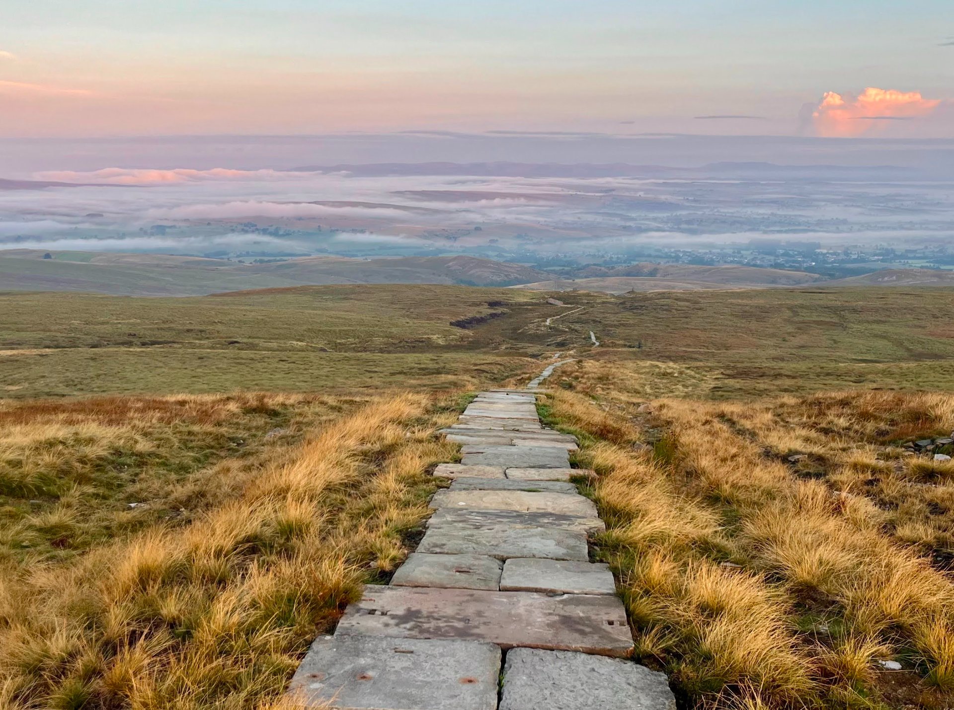
Another big day and another early start. I hit the trail at 4:30am. A nice walk through town and then a gentle climb mostly on a gravel road until a paving stone trail leading to the Nine Standards Rigg.
I was racing the sunrise and hurrying to the top; luckily there was still some nice morning lighting when I got there at 6am and I took some time to take it all in.
Then off I went; the paving stones made this part of the trail very quick. There were some clouds below me and it felt like you could see for quite a ways. I scared so many grouse; their calls sounded so funny as they flew off the trail!
As you get towards Keld there is a two-mile-long section of road walking. This road is pretty narrow and rather busy with very little shoulder. I decided to stick to a trail and then the gravel road that runs along River Swale until reconnecting at the halfway marker. What an exciting sight! Halfway and only 2 1/2 days left. There was a lovely waterfall nearby and I enjoyed a snack on one of the benches.
My feet were tired, but I got myself moving and enjoyed the valley walk. Soon you come to a decision point, either take the high route over the moors or the low route through the valley (with food and drink options). I took the moors. It was also not my favorite landscape; it felt like a time loop. Endless heather with very little change on the horizon. I was surprised by the number of other hikers. If I were to do it again I might do the low route.
Finally you start descending and going through farms until reaching Reeth. What a cute town Reeth is! I needed a little moral boost and this town delivered. Cute stone buildings surrounding a big grass field. This town had a fun, relaxing atmosphere and the people were so friendly. I enjoyed talking to a few folks while I got some water.
Just a little further down the road I stopped at the Dales Bike Centre and had an amazing sandwich, coffee, and cake. They have a lovely yard and I enjoyed my food under some very nice trees. After this the trail follows the River Swale a bit more and the shade was so welcome. Then there is a mix of farms and quiet country roads. Occasionally the trail goes through a section of woods.
As you get close to Richmond there is a nice forested section and then you pop out onto a road and follow that into town. Richmond was a fun town with lots of grocery and food options. There is loads of historic charm here! I didn't find a hotel room for a reasonable price available in town but I did find a lovely Airbnb.
Day 5: Richmond to Clay Bank
35.4 miles, 3,750 ft gain, 3,697 ft loss
Water refill options: Ingleby Arncliffe (at the service station on the A19 or at a cafe).
Another early 4:30am start, yippee! The Airbnb host was so kind and had a bowl of yogurt and fruit for me. My feet were so tired this morning; going down the stairs was a little painful. Thankfully, after I started walking, my feet warmed up a bit and the aches and pains lessened.
There was a nice short section by the river and then some wooded walking. Around sunrise I walked through a field of sunflowers and surprised a few deer in the middle of enjoying their breakfast. There was one long section where I had to walk through the St Giles dairy cow farm. There were so many cows; they were all staring me down. I looked for an alternative route but didn’t find one. Eventually I went for it and except for a few huffs and looks from the cows they didn’t seem bothered by my presence. I still gave them as much space as possible.
The Catterick Complex was nice and had a number of ponds. I wish I had had my binoculars so I could do a little birding! After this it was miles and miles of farms. So many farms.
Sheep, dead grass, and what was left of the harvested crops. It was actually a little tricky to find a place to sit or pee. I put on a good audiobook and got to walking.
As you get close to the A19 dual carriageway crossing you can do a 5-mile detour to a pedestrian overpass or get ready for a dash across the road. You pop out next to a gas station so it’s a good spot to observe the highway. I had been nervous about this crossing but there is a nice grass median so you only have to worry about two lanes of traffic at a time. I had to wait a little while but a nice gap opened up and I made it across easily. I heard that the 5-mile detour is also a bit risky with narrow country roads.
Ingleby Arncliffe was just a few minutes away and I had a lovely lunch at the Joiners Shop Coffee & Kitchen. They had a beet latte that I loved! Sounds odd, but it was mostly licorice (star anise) flavored. At this point it was already 12:30pm and I still had a long way to go.
On I went and finally I was mostly done with the farms for the day. A little bit of road walking and then you get to some forested trails as you start going uphill towards the North York Moors.
There is a bit of up and down; you'll get to the top of a hill and get a lovely view then go back down just to go up another hill. The views were very nice though and I could see all the way to the coast. The Wainstones were short and cute, nice to break up the scenery with a little bit of rock.
Since I booked my hike rather last minute, my first choice accommodation for the evening (Beak Hills Farm) was booked, but I got a lovely shepherd's hut down at Clay Bank Huts. It was a mile off the trail, all downhill to get there (but it would mean a steep uphill in the morning). I got to the hut at 6:20pm; it was a very nice hut and the owner even offered to give me a lift to the trailhead in the morning. Uber Eats also delivers here, and I got some fantastic Indian food.
Day 6: Clay Bank to Robin Hood's Bay
36.8 miles, 3,553 ft gain, 4,386 ft loss
Water refill options: Grosmont.
Last day! Wahoo! It felt like it would never come, but it also somehow felt like I had just started. Another 4am start and the hill started right away. This time my husband was joining me for parts of the day, so that kept my spirits up. There was already a bit of light by the time I got up to Round Hill, even though sunrise was still a way away. The trail leveled off and I was surrounded by heather. You start to go away from the edge of the hills and onto more of a plateau. Very flat, lots of heather, and the view stays pretty similar for many miles.
After a few miles I made it to Blakey Ridge and the Lion Inn (another option that was fully booked). I had lucked out with the weather, but now the rain started to drizzle. A mix of trail and road walking as you start to go slightly downhill toward Glaisdale. It is a pretty small town but cute. As you leave Glaisdale there is a nice section of forest walking.
Egton Bridge is an even smaller town just a few miles down the road with a cute river crossing. Some road and trail walking but pretty flat. I got a snack in Grosmont and then there’s a bit of elevation gain leaving town. It’s all on road, which is a bit annoying, but I ran into a fun group of hikers and we had a nice chat.
Finally on the other side of the hill you get back on some trail and start going downhill. A tendon in my foot was starting to really hate the downhill and started slowing me down quite a bit.
At the bottom of the hill is Littlebeck (mostly just a collection of houses), but just after that is Little Beck Woods, one of the highlights today. There was a lovely creek, beautiful forests, and even a waterfall. The rain had stopped and the sun was out; I didn’t want the woods to end. Sadly the woods ended, and it was time for a bit more uphill.
You can see where a forest fire occurred up there not too long ago. The trail has mostly been fixed but the landscape is pretty bleak. In the distance I could see the ocean though! My foot was really hurting at this point but I was so close. I hobbled my way down the hill and toward the coast. Some more road walking and eventually you get to a mobile home/holiday park. Walk through that and the coastal path awaits!
It was so nice to have something interesting to look at. There were seals down below and the cliffs were lovely. Three miles later I was in Robin Hood's Bay. I tossed my pebble into the ocean and headed to find some dinner. What a trip!
Overall Thoughts
This trail was a fun challenge, especially doing it in a shorter timeline. I was glad I did it at a faster pace as it helped me get through some of the less interesting farm and flat areas quicker. Do this trail more for the history and novelty of walking across a country, less so for the views. Though the lakes at the start of the trail were the highlight for me and definitely had some great views. The trail is in great condition and much of it (especially after the Lakes) is runnable. I enjoyed seeing how much the landscape changed from one coast to the other. Coming from North America it was a fun treat to not have to carry a tent and get so many hot showers! I felt very comfortable doing this trail solo. When you know your dates, book accommodations as soon as possible; they do fill up. If you're planning on eating at restaurants, especially in the small towns, make sure to book a dinner reservation.